From Cultural Heritage to 3D Cadastre, ITB Promotes AI-Based Geospatial Innovation
By Merryta Kusumawati - Mahasiswa Teknik Geodesi dan Geomatika, 2025
Editor Anggun Nindita
.jpg)
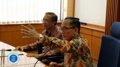
BANDUNG, itb.ac.id — Institut Teknologi Bandung (ITB), through the Faculty of Earth Sciences and Technology (FITB), held an international seminar titled “Bridging Heritage, AI, and Cadastre: International Perspectives on 3D Geospatial Research” on Monday (24/11/2025). The seminar brought together geomatics experts from Italy, France, and Indonesia to discuss the latest developments in three-dimensional (3D) geospatial technology, cultural heritage documentation, artificial intelligence (AI), and modern cadastral modeling.
The event was officially opened by the Dean of FITB ITB, Dr. techn. Dudy Darmawan Wijaya, S.T., M.Sc., who expressed his appreciation for the participation of international speakers and the enthusiasm of attendees in this cross-border academic forum. He emphasized that the seminar served as a strategic platform for exchanging ideas and strengthening international networks and collaboration, particularly in the rapidly evolving field of geomatics.
“This forum opens opportunities for research collaboration and knowledge exchange, especially in addressing the increasingly complex challenges of modern geomatics,” he said.
AI and Deep Learning for Modern Geomatics Challenges
The first session was delivered by Prof. Fabio Remondino from Fondazione Bruno Kessler (FBK), Italy. He presented the evolution of artificial intelligence applications in photogrammetry and computer vision, particularly for 3D mapping. Through deep learning approaches, many classical challenges in geomatics—such as image matching, tie point extraction, and 3D reconstruction—can now be addressed more efficiently.
“Many longstanding problems in geomatics can be solved using machine learning, ranging from day–night image matching and reduced overlap requirements to the integration of vision transformers for multimodal object detection,” Prof. Remondino explained.
He also highlighted the potential of vision transformers, which enable aerial image analysis through language-based commands, allowing users to search for specific objects using textual instructions.
Best Practices in 3D Cultural Heritage Documentation from Strasbourg
The next speaker, Prof. Pierre Grussenmeyer from Université de Strasbourg, France, shared the extensive experience of his research group in documenting and modeling cultural heritage objects across Europe. He outlined the evolution of recording technologies, from conventional photogrammetry to the use of mobile mapping systems and 360-degree cameras for urban-scale documentation.
According to him, accurate data orientation is a key factor in producing reliable 3D models. “Advanced technology will not be effective if the initial data orientation is incorrect. Geometric errors will affect the entire reconstruction process,” he stressed.
Digital Twins and Semantic Challenges in 3D Documentation
The third session was presented by Dr. Arnadi Murtiyoso, an ITB alumnus currently affiliated with Université de Strasbourg. He introduced research that integrates 3D documentation with digital twin concepts to support cultural heritage preservation.
Dr. Arnadi highlighted the technological shift from traditional mesh-based models to neural 3D representations, such as Gaussian Splatting, which offer more realistic visualizations. However, he emphasized that these approaches still face limitations in providing semantic information.
“We now have excellent visualizations, but they are not yet semantically rich enough for scientific purposes. The next challenge is how to embed semantic meaning into 3D representations so they can be used across disciplines, such as by archaeologists and architects,” he explained.
He also showcased research integrating Internet of Things (IoT) sensors with 3D models to predict future changes in heritage objects due to climate influences.
Digital Documentation of Majapahit: Integrating LiDAR, Photogrammetry, and AR
Representing Indonesia, Husnul Hidayat, S.T., M.T. from Institut Teknologi Sepuluh Nopember (ITS) presented a digital documentation project of the Majapahit site under the PHC Nusantara program. The project utilized an integrated approach combining laser scanning (LiDAR), drone imagery, and high-precision Global Navigation Satellite System (GNSS) data to model temple structures that are largely buried beneath the ground surface.
The survey data were further developed into augmented reality (AR) applications and 3D-printed models for educational and archaeological research purposes. “The Majapahit site has a highly complex character. Integrating LiDAR and photogrammetry is essential to ensure accurate 3D reconstruction without disturbing the site,” he explained.
AI for 3D Cadastral Modeling in Indonesia
The final session was delivered by Dr. Ratri Widyastuti from the Geospatial Cadastre and Land Administration Research Group at ITB. She discussed recent research developments related to 3D object characteristics and the challenges of implementing three-dimensional cadastre systems in Indonesia.
According to her, cadastral data are highly complex and inefficient to process manually. “With artificial intelligence, object extraction, spatial boundary identification, and the generation of 3D cadastral models can be carried out more automatically and accurately,” she explained.
She also emphasized the importance of 3D cadastre in supporting modern land administration, particularly in urban areas with multi-story buildings and overlapping ownership rights.
Interactive Discussions and Global Collaboration Toward the Future of 3D Geospatial
The discussion session was highly interactive, featuring questions on 3D model accuracy, the application of Gaussian Splatting, 24-hour thermal camera usage, multisensor data integration, and the impact of climate change on the degradation of historic building materials. The speakers emphasized that the future of geomatics extends beyond detailed 3D visualization to the integration of physical, environmental, and social data to support more comprehensive spatial decision-making.
At the conclusion of the seminar, both speakers and participants expressed their hope that collaboration between ITB and international institutions would continue to grow through joint research, academic exchanges, and the development of innovative technologies in photogrammetry, artificial intelligence, cultural heritage documentation, and 3D cadastre. Through this forum, ITB reaffirmed its role as a center for geospatial science and 3D modeling technology development in Indonesia, as well as a platform for scientific dialogue among academia, government, and industry in addressing future spatial management challenges.
.jpg)
.jpg)
.jpeg)
.jpg)
.jpg)

.jpg)