PWK ITB Student Team Achieves National Recognition through Geospatial-Based Environmental Studies
By Indah Marcelinawati - Mahasiswa Perencanaan Wilayah dan Kota, 2022
Editor Muhammad Efriza Pandia
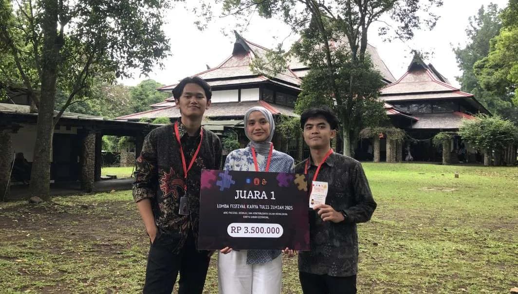
BANDUNG, itb.ac.id - Three students from the Urban and Regional Planning (PWK) Study Program at Institut Teknologi Bandung (ITB), Farid Ramadhani, Fajar Nur Adnan, and Zeba Liqueiza SK, are successfully won First Place at the FKTI Geopoint 2025 competition. This national-level competition focuses on innovations in geospatial mapping and analysis to address various national and global issues.
In the competition, the team, named Pangripta Maung, raised the theme of environment and conservation, with Gunung Leuser National Park (GLNP) as their study area. They highlighted the issue of human–wildlife conflict, particularly involving orangutans, whose natural habitats are increasingly threatened by human activities and environmental change.
Through a spatial analysis approach, the team conducted mapping to identify suitable locations for orangutan observation while also analyzing environmental conditions that support the species’ survival. One of the study’s key strengths was the application of the Maximum Entropy (MaxEnt) method, a predictive modeling technique that is still relatively uncommon in similar competitions.
.jpg)
Behind this achievement, the team faced several challenges. As final-year students, they had to balance competition preparation with demanding academic responsibilities. Time management became the main challenge throughout the preparation process.
To address this, the team made use of free time before classes, implemented an asynchronous working system, and developed a structured and measurable project timeline. This strategy allowed the preparation process to remain effective despite differing individual schedules.
The team’s success was also strongly supported by their academic supervisor, Hanafi Kholifatul Iman, S.T., M.P.W.K. He provided substantive guidance, from assisting in the formulation of analytical variables to refining the final presentation so that it was more systematic and easier to understand.
For the three students, the competition offered valuable experience and insights. Zeba noted that the field of spatial analysis provides a wide range of software tools that can still be further explored. Meanwhile, Farid emphasized the importance of developing a clear and realistic timeline to ensure that objectives can be achieved optimally.
They also encouraged other students to take part in similar competitions. “Prepare an analytical concept that you truly understand and that has its own uniqueness. This will be an added value that makes your work stand out in the eyes of the judges,” said Farid Ramadhani.
.jpg)
.jpg)
.jpeg)
.jpg)
.jpg)
.jpg)

