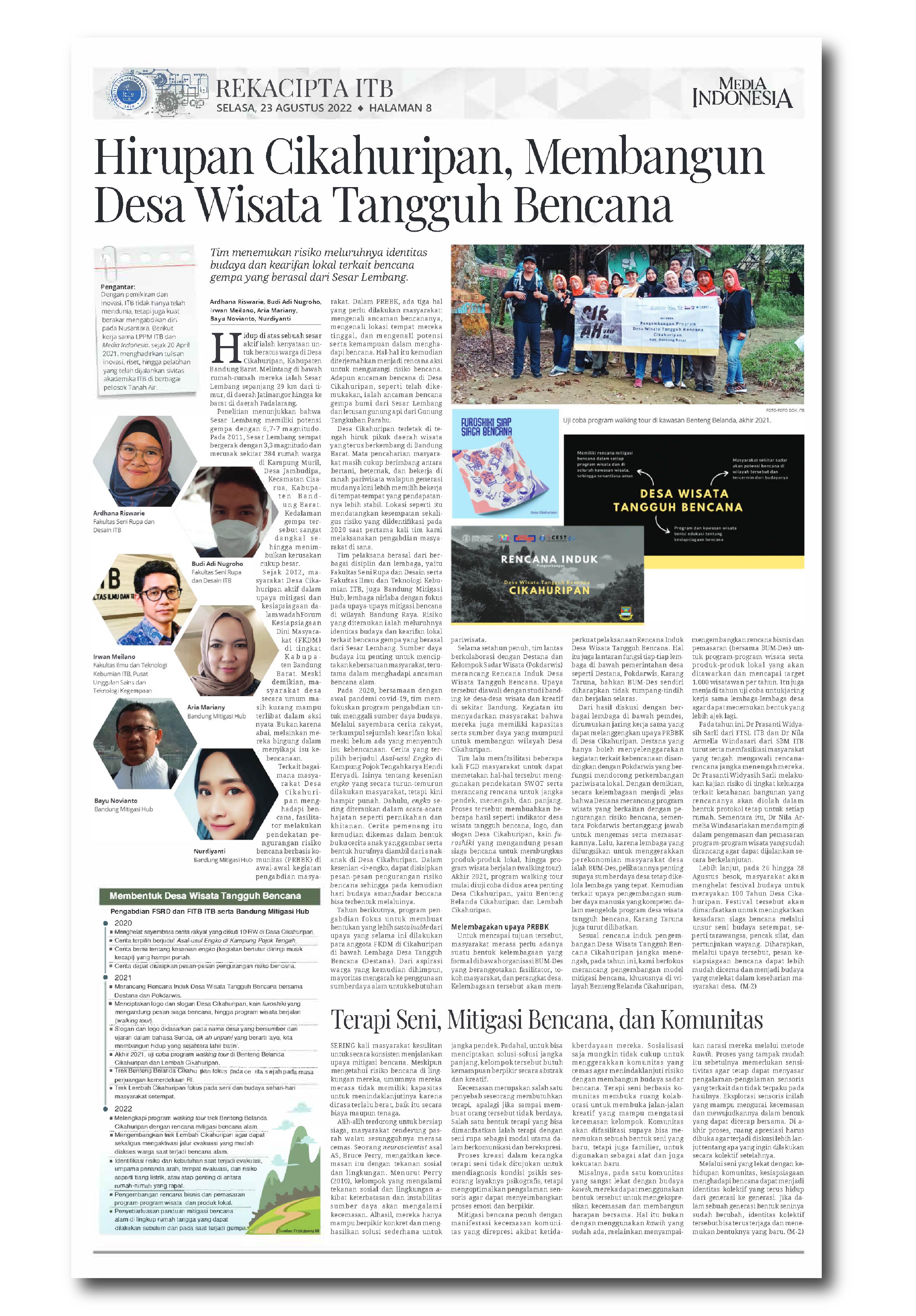
Dr. Zulfakriza Explains the Application of Geophysics for Natural Resource Exploration and Disaster Mitigation in a Public Lecture at UNP
By Rayhan Adri Fulvian - Mahasiswa Teknik Geofisika, 2021
Editor Anggun Nindita
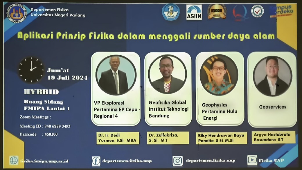
PADANG, itb.ac.id – Dr. Ir. Zulfakriza, S.Si., M.T., a lecturer from the Geophysics Engineering Research Group at the Faculty of Mining and Petroleum Engineering, Institut Teknologi Bandung (ITB), was invited as a speaker in a public lecture titled “Application of Physics Principles in Exploring Natural Resources” organized by the Department of Physics, Faculty of Mathematics and Natural Sciences, Universitas Negeri Padang (UNP).
The event also featured prominent professionals such as Dr. Ir. Dedi Yusmen from Pertamina EP Cepu Regional 4, Rifky Hendrawan Bayu Pandito from Pertamina Hulu Energi, and Argya Hastubrata Basundara from Geoservices.
In his lecture titled "Us and Geophysics," Dr. Zulfakriza elaborated on how geophysics principles can be utilized for natural resource exploration, disaster mitigation, and infrastructure development. Geophysics, an interdisciplinary science combining physics, geology, and mathematics, employs instrumentation, computation, and observation to understand Earth’s dynamics.
He illustrated Earth's dynamic patterns through seismological exploration techniques, applicable to both oil and gas (O&G) and mineral mining. For O&G exploration, methods such as active seismic (refraction and reflection), passive seismic, gravity, and geomagnetic surveys are used. Meanwhile, mineral exploration relies on geoelectric, gravity, electromagnetic (EM), and exploratory seismology methods. He also discussed how subsurface exploration supports infrastructure development and disaster mitigation, presenting seismic data analysis and beachball visualizations to estimate seismic impact in specific regions.
One of the most engaging topics in the discussion was Ambient Seismic Noise, a passive seismic method that has gained traction in recent decades. Based on interferometry principles, this method utilizes natural vibrations to extract data by cross-correlating signals from two seismic stations. The resulting data provides information on wave travel time and group velocity, which can then be used to generate dispersion curves and analyze subsurface structures.
Dr. Zulfakriza also introduced the Ambient Noise Tomography (ANT) method, which has been implemented in several regions of Indonesia, including Central Java, Mount Jailolo, Mount Merapi, and the Banyumas Basin. ANT helps scientists obtain subsurface wave velocity images using inversion techniques such as Fast Marching Surface Tomography and Transdimensional Inversion.
This public lecture provided valuable insights into geophysics and its industrial applications, emphasizing how the field offers significant opportunities for optimizing Indonesia's natural resource utilization and protection.
Reporter: Rayhan Adri Fulvian (Teknik Geofisika, 2021)
Translator: Indira Akmalia Hendri
.jpg)
.jpg)
.jpg)
.jpg)

.jpg)