ITB Volcanologist: People Around Mount Ruang Need to Stay Alert
By Anggun Nindita
Editor Anggun Nindita

BANDUNG, itb.ac.id — Mount Ruang, located in Sitaro Regency, North Sulawesi, erupted on Tuesday night (16/4/2024). The eruption of Mount Ruang spewed hot lava and smoke which resulted in seismic activity that could potentially lead to tsunami in the surrounding areas.
The previous status of the volcano from Level III (CRITICAL) has now changed to level IV (HAZARDOUS).
Taken from the Regional Disaster Management Agency (BPBD) official website, regions affected by the eruption include Pumpente Village and Patologi Village in Tagulandang District, Sitaro Regency, North Sulawesi.
The eruption of Mount Ruang impacted as many as 272 families or 828 people being evacuated, with 45 people in the BPU Building of Tagulandang District while 783 others evacuated to the homes of relatives living in the mainland of Tagulandang Island, which was considered a safer environment.
A volcanologist from Institut Teknologi Bandung (ITB), Dr. Mirzam Abdurrachman, S.T., M.T., helped explain the eruption phenomenon of Mount Ruang in North Sulawesi.
According to him, volcano activity on Mount Ruang has recently become one of many volcanoes that have a tendency to simultaneously erupt around this time. Other volcanoes with similar properties includes Mount Merapi in Central Java, Mount Semeru in East Java, Mount Marapi in West Sumatra, and Mount Lewatolo in East Nusa Tenggara (NTT).
As previously known, Indonesia holds 4 groups of volcanic arcs, a volcanic chain that forms on its plates and is positioned like an arc when viewed from above.
"The 4 groups are the Sundanese slope, the Banda slope, the Halmahera slope, and the Sangihe-Selebes slope. Mount Ruang is part of the Sangihe-Selebes slope and is located at the tip of North Sulawesi which is close to the Philippines. Following this information, we calculated that in the near future, there are several other volcanoes that may erupt," he said in an official statement on Friday (19/4/2024).
"Multiple volcanoes that began to simultaneously activate can be caused by 2 things: if they are located on the same slope as Mount Merapi, Mount Semeru, and Mount Marapi, this eruption may act as an "event organizer" for other eruptions because the volcanic plates that interacts are the same. If it is on a different slope such as Mount Lewatolo and Mount Ruang, it is caused by the similar eruption interval, " he continued.
He added that these volcanoes can erupt due to the disturbed balance of the magma chamber. There are three processes that can cause such disturbances, namely: injection of new magma, separation of gasses and solids from the solution that increases the pressure inside the magma chamber, and activities above the magma chamber like landslide happening to the volcano body, heavy rain, full moon tides, and typhoons.
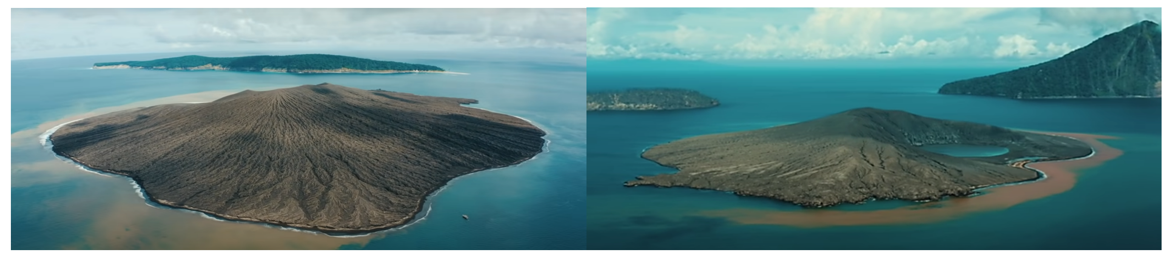
He also mentioned that Mount Ruang is a common stratovolcano in Indonesia and its eruption is an interlude between lava flows and explosive eruptions. The thing that distinguishes it from other volcanoes is its location which happens to be in the middle of the sea.
Potential Danger of Mount Ruang Eruption
Given its location in the middle of the sea, he said that there are several potential dangers from the eruption of Mount Ruang, with the first being the potential for a tsunami.
He explained that the eruption of Mount Ruang can trigger a tsunami if landslide material enters the sea or if the slopes of the volcano collapse. Then, Mount Ruang can release lava flows and pyroclastic which are hazardous to the surrounding community.
"Furthermore, volcanic ashes produced can also disrupt respiratory health and damage the surrounding ecosystem," he explained.
Another possible post-eruption alert of Mount Ruang that gained public attention was the flash phenomenon. However, according to him, this is common in volcanic activities.
"When a volcano erupts, generally, particles of the volcano create friction forces causing what is called eruptive lightning or volcanic eruption lighting," he said.
History of Mount Ruang Eruptions
Referring to past data, it is known that the eruption of Mount Ruang once triggered a tsunami in 1871 with an eruption scale or Volcanic Explosivity Index of 2. Approximately 400 people died as a result of the disaster.
Tsunamis that occur due to volcanic activities are called volcanic tsunamis. "At the time of the eruption in 1871, eyewitnesses said the tsunami that occurred was 5 meters high. But some say it was up to 25 meters on the surrounding island. Nevertheless, the incident can have an impact," he explained.
He stated that there are still limited databases covering Mount Ruang eruptions. However, he warned that long periods of eruptions can indicate a greater energy level in the next eruption.
"So the interval is not far, but we can understand that the accumulated volume will increase when the period between eruptions is longer, compared to shorter eruption period," he explained.
"It needs to be understood that erupting volcanoes is a way of expending energy and achieving balance. Eruptions can occur in large numbers all at once or little by little, depending on the characteristics of the volcano," he continued.
Disaster Risk Advisory
People around Mount Ruang are urged to remain vigilant and cautious in entering areas within a radius of 7.5 kilometers from the center of Mount Ruang's active crater. He also advised the people near Mount Ruang to use moistened masks for maximum protection from volcanic ash to protect respiration from the dangers of volcanic ash.
"Avoid coastal areas around Mount Ruang to anticipate the potential for tsunami," he said.
That way, the community around Mount Ruang can be prepared to face the risks of eruptions. The general public is also urged to stay alert and follow directions from the authorities and related agencies.
Reporter: Anggun Nindita
Translator: Kezia Hosana
Editor: Hanifa Juliana (Urban and Regional Planning, 2020)
.jpg)
.jpeg)
.jpg)
.jpg)
.jpg)

.jpg)