ITB Hydrography Team’s Preparations to Face Tsunami in Pangandaran Village
By Adi Permana
Editor Adi Permana
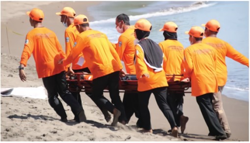
BANDUNG, itb.ac.id—Pangandaran Village is one of the tsunami-risk zones in West Java. Led by Dr.rer.nat. Wiwin Windupranata, the ITB Hydrography Research Group conducted field surveys in Pengandaran Village to meet all 12 indicators of the UNESCO Tsunami Ready Program.
The program was designed by UNESCO and IOC (Intergovernmental Oceanographic Commission). It aims to raise the residents' awareness and preparedness in response to a tsunami. The ITB community service team had run surveys in November 2020 and March 2021 through its Bottom-Up Community Service project.
Dr. Wiwin stated that there were several indicators in the Tsunami Ready Program. The first indicator to be completed is determining the areas prone to tsunamis. These locations- along with datasets from the numerical modeling of the government's tsunami inundation maps and study results by experts- are plotted on a tsunami hazard map.
Secondly, the estimated number of residents residing in the risk zones is set as an indicator. This information is obtained from the 2021 Pangandaran Village data. On the other hand, the third indicator specifies the placement of public information services about the evacuation routes, preferably along the coast of the village. However, this indicator needs to be revised because there were errors in the coordinates. Then, the fourth indicator is the availability of economic, infrastructure, political, and social resources to mitigate the risk of disaster.
“Referring to the interviews during the field surveys, the management of the Pangandaran Village has fulfilled the economic aspect of the program via fundings for disaster countermeasures. The infrastructure side is completed as well by locating temporary evacuation points at Cagar Alam area and five-stories evacuation shelters on the border of Pangandaran and Pananjung Village," he mentioned, as written in Rekacipta ITB Media Indonesia (Tuesday, 12/14/2021).
Additionally, the provision of seven hotels as evacuation points is prepared due to the large number of tourists in Pangandaran. On the political and social aspects, the regional government and FKDM (Community Preparedness Forum) had drafted an EOP (Emergency Operation Plan) document. Its effectiveness can be observed through evacuation simulations.
“FKDM Pangandaran and BPBD (Regional Disaster Management Agency) has organized a program to anticipate the impact of the disaster as well as activities to educate the public about it in Pangandaran. The Linmas Organization, along with fishermen and tourism entrepreneur communities in Pangandaran, also support these activities," he explained.
The fifth indicator is assembling evacuation maps that are easy to understand. Creating these maps involves cooperation between local authorities, residents, and agencies like BNPB (Indonesian National Board for Disaster Management), BPBD, and BMKG (Meteorology, Climatology, and Geophysical Agency). Corrections concerning differences in details and the purpose of the evacuation are required.
The GTS (Goes To School) program- which is the sixth indicator- aims to educate elementary, junior, and high school students about tsunamis and how they should respond to them. BMKG also designed study materials regarding tsunamis to be nationally implemented into the school curriculum.
The seventh indicator focuses on socialization events initiated by BPBD Pangadaran and FKDM Pangandaran that are held at least three times annually. Examples were the Disaster Alert Day on April 26, Pangandaran Tsunami Warning on July 17, and GTS.
The eighth indicator is training the community about the dangers of tsunamis via drills. This occurs once every two years. Meanwhile, the ninth indicator is the creation of EOP and is reported as the Decree of the Head of Pangandaran Village Number 144/47-Kpts/Desa/2020. The document is done during the same period as the eighth indicator and acts as the basis during a tsunami occurrence.
The tenth indicator is the region's capacity to support the tsunami emergency response, which is accomplished by both FDKM and Linmas cooperation. This also applies to other natural disasters such as earthquakes.
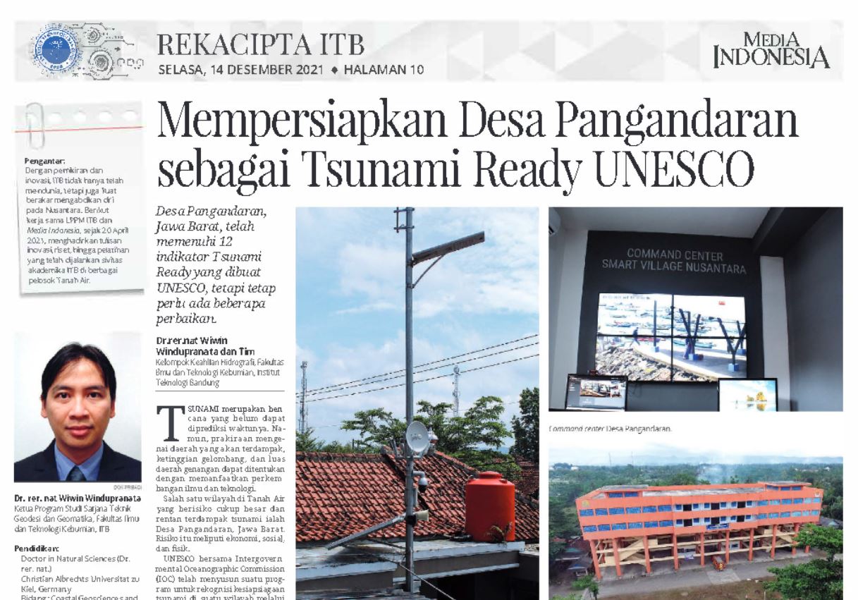
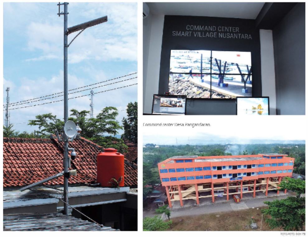
The eleventh indicator is the availability of media to perform emergency response decisions and spread both alerting information. This is done through social media, command centers, as well as monitoring devices such as CCTV, sirens, and loudspeakers.
The command center in the Pangandaran Village Office is connected to communication devices placed at various tourist spots (East Coast, West Coast, etc.) and the office itself. The region’s official website, SMS, and Warning Receiver System are also utilized to share official information from BMKG.
The twelfth indicator explains the tools needed to spread information to the public. Such tools are walkie-talkies, social media, speakers, as well as sirens on the command station and the Telkom Pangandaran Building.
“Commitment from both the community and government is needed to maintain these indicators and disaster mitigation infrastructure so that damages and loss from the disaster are minimized," Dr. Wiwit mentioned.
*This community service report has been published in the ITB Design rubric of Media Indonesia. A more detailed article can be read on https://pengabdian.lppm.itb.ac.id
Reporter: Amalia Wahyu Utami (Teknik Fisika 2020)
Translator: Ruth Nathania (Teknik Lingkungan, 2019)
.jpg)
.jpeg)
.jpg)
.jpg)
.jpg)