Oceanography ITB Public Lecture Revealed the Paleogeography of the Indonesian Archipelago
By Adi Permana
Editor Adi Permana

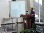
BANDUNG, itb.ac.id— The Oceanography Study Program ITB presented a public lecture on the Paleogeography of the Indonesian Archipelago. Dr. Ayi Tarya, Chair of the Oceanography Study Program, formally launched this activity. When he opened the event, he expressed his enthusiasm for presenting the first public lecture in the NUSANTARA Program series, which is the 2021 Basic Partnership Research Scheme.
"The collaboration with the Université de Nantes, the Institut des Sciences de la Terre, the Indonesian National Research and Innovation Agency (BRIN), the Indonesian Ministry of Maritime Affairs and Fisheries (KKP), and the Merdeka Campus program from the Ministry of Education and Culture, cannot be separated from the continuation of this activity," he said.
Dr. Tubagus Solihuddin, M.T., was the guest speaker at the public lecture on Friday (17/09). With a research focus on geomorphology and sea level rise, he is an associate researcher at the Marine Research Center, Marine and Fisheries Research and Resources Agency, KKP RI.
Tubagus started his presentation with the progression of the Indonesian Archipelago's creation. It began to develop 50 million years ago in the early Eocene and continued until 5 million years ago in the early Pliocene.
“This creation is inextricably linked to the numerous hypotheses advanced by specialists. Igneous rocks record magnetic characteristics during formation, confirming Alfred Wegener's idea of continental drift. Furthermore, by estimating the age of rocks and paleoceanography, Harry Hess detailed the spreading of the ocean floor. Furthermore, the movement of the earth's plates has an effect," he stated.
These numerous development processes finally led to formation of the Indonesian archipelago. The natural physical form of Indonesia is heavily influenced by tectonic processes that occur. Indonesia is situated between four tectonic plate collisions, which has resulted in a large number of volcanoes.
“This volcano's seismic activity is controlled by tectonic trends. This process also causes a number of active defects, which may be mapped by experts,” he explained.
He then went on to explain sea level and coastal dynamics. The Sunda Shelf and the Sahul Shelf were linked landmasses fourteen thousand years ago. Papua New Guinea and Australia are similarly affected. At the time, the sea level was still 120 meters lower than it is today.
"Several factors can influence sea level changes, including melting polar ice caps, rising sea temperatures, deformation, subsidence, or elevation of the ocean floor, and the interaction of surface water with groundwater," he explained.
Mangroves and coral reefs can serve as indications of sea level rise. “As sea levels rise, mangroves and coral reefs will adapt. Some will survive, while others will struggle to keep up with the pace of change. Will Jakarta and other Indonesian islands be submerged in the next years? The answer is still being studied by specialists and researchers,” Tubagus concluded his presentation.
Reporter: Maharani Rachmawati Purnomo (Oceanography, 2020)
Translator: Sekar Dianwidi Bisowarno (Bioengineering, 2019)

.jpg)
.jpg)


.jpg)


