Strengthening Earthquake Mitigation: Gabriella Alodia, S.T., M.Sc., Ph.D. (FITB ITB), Conducts Community Service Program in Pulau Madu and Pulau Karumpa
By Merryta Kusumawati - Teknik Geodesi dan Geomatika, 2025
Editor M. Naufal Hafizh, S.S.
BANDUNG, itb.ac.id - Gabriella Alodia, S.T., M.Sc., Ph.D., a lecturer from the Hydrography Research Group at the Faculty of Earth Sciences and Technology (FITB) ITB, carried out a community service program in Pulau Madu and Pulau Karumpa, Selayar Islands, in early September 2025. The activity was part of the ITB DPMK program under the 3T scheme, aimed at supporting disaster education in underdeveloped regions.
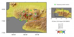
Pulau Madu and Pulau Karumpa were selected due to their close proximity to the source of the M7.3 earthquake that occurred in 2021. Although four years have passed, traces of fear and limited access to emergency assistance remain evident on these small islands. Responding to this situation, the ITB team sought to enhance disaster literacy and provide essential mapping data for future mitigation planning.
"The communities here still carry strong memories of that major quake, making education and preparedness efforts urgently needed," said Dr. Gaby.
Earthquake Education and Drone Mapping

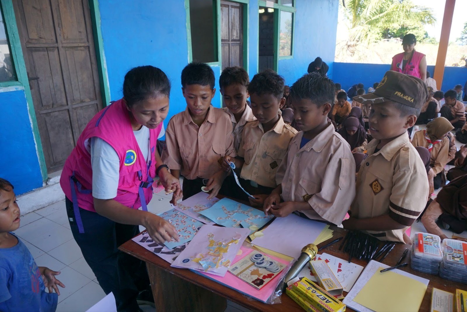
During the three-day field program, the team conducted earthquake education activities for elementary and junior high school students, as well as women’s groups. Interactive approaches such as coloring activities, simple games, and informal discussions were used to build rapport and ease community anxiety related to earthquakes.
On the technical side, the team captured aerial imagery using drones to produce base maps of Pulau Madu and Pulau Karumpa. These maps will serve as initial references for designing evacuation routes and safe zones, while also supporting the development of future disaster resilience programs.
"These small islands are among the closest to the 2021 earthquake source. Mapping is crucial to make evacuation planning clearer and easier for communities to understand," Dr. Gaby explained.
Challenges in Access and Coordination

Access to both islands is limited and relies on wooden boats, creating logistical challenges for the team’s mobility. Cross-institution coordination also required adaptation, as the team involved multiple groups: ITB, the local community organization Rumah Baca Saku, the Selayar Marine and Fisheries Office, and collaborators from Universitas Brawijaya.
Despite these challenges, the activities ran smoothly thanks to strong community support and culturally sensitive approaches facilitated by local coordinators. The social dynamics between Pulau Madu and Pulau Karumpa also provided valuable insights into more effective communication strategies.
"Each island has its own dynamics and communication style, so we had to learn and adapt along the way," Dr. Gaby noted.
Organically Formed Cross-Disciplinary Collaboration
The program also demonstrated how cross-disciplinary collaboration can grow organically. The cooperation between ITB and Universitas Brawijaya emerged from informal discussions on the Sendai Framework, while the collaboration with ITB’s Faculty of Art and Design (FSRD) developed through the creation of visual education materials and a pop-up earthquake book.
"None of this was planned from the beginning small conversations opened the door to much broader collaborations," Dr Gaby shared.
Hopes for Program Sustainability
Looking ahead, the team hopes that this initiative will evolve into a sustainable program with expanding benefits for the community. Planned follow-up activities include child-friendly earthquake simulations, enhanced risk awareness programs, and the use of drone-derived maps for village planning.
Through these efforts, ITB aims to continue strengthening disaster literacy in vulnerable island regions and to foster long-term partnerships that support community resilience.
Reporter: Merryta Kusumawati (Geodesy and Geomatics Engineering, 2025)
.jpg)
.jpg)
.jpg)
.jpg)