Dr. Ir. Kosasih Prijatna, M.Sc.: Distinguish Indonesia-Malaysia Border in Sebatik Island
By Luh Komang Wijayanti Kusumastuti
Editor Luh Komang Wijayanti Kusumastuti
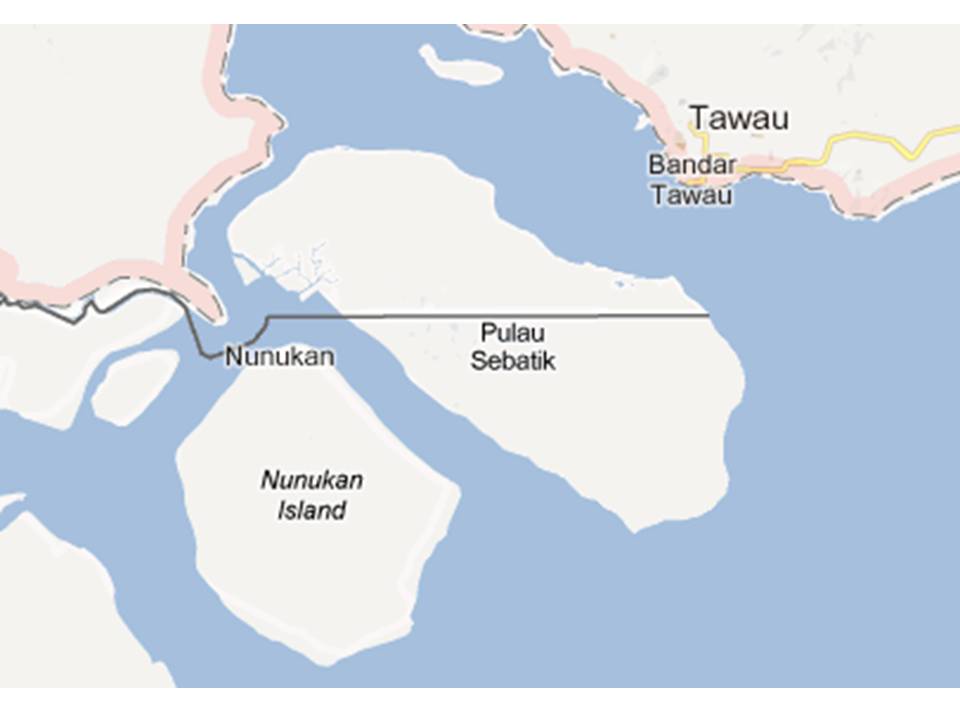
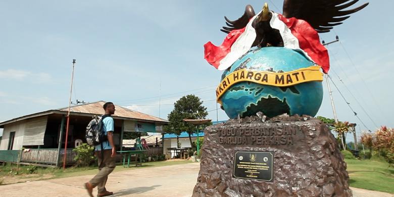 BANDUNG, itb.ac.id - Unclear boundaries in several areas between Indonesia and neighboring countries is a common topic in society. The boundary in Sebatik Island is one of them. Sebatik is a small island located in Kalimantan east coast that is officially listed as one of the 92 remote islands in Indonesia. The island is divided into 2 regions; Malaysian Sebatik in the northern part, and Indonesian Sebatik in the southern part, with 25.000 people living in Malaysian Sebatik and 80.000 people living in Indonesian Sebatik. Even though there are border guards, the two different area does not have walls or barbwire to mark the border clearly.
  Regarding to this problem, a geodesy lecturer from Institut Teknologi Bandung (ITB), Dr. Ir. Kosasih Prijatna, M.Sc. conducted a research on boundary problems between Indonesia-Malaysia in Sebatik Island. This research was conducted by Dr. Kosasih alongside with Heri Andreas, S.T., M.T., Dr.Ir. Hasanuddin Z. Abidin, M.Sc., Ph.D., and Irwan Gumilar, S.T.,M.Si. Dr. Kosasih is the Head of Geodesy and Geomatics Undergraduate Program that earned his bachelor degree in Geodesy Engineering ITB, graduated with master's degree from The Ohio State University, and doctoral degree from Department of Geodetic Science & Surveying ITB.
The research on borderlines between Indonesia and other countries has been done by Geodesy and Geomatics Department faculty of ITB since 2000. Until now, the Sebatik research is still ongoing, as with the other neighboring countries boundary research. The research in Sebatik started from map tracking, continued with measuring and checking the coordinates of boundary markings. Coordinate checking is done using GPS (Global Positioning System) and images were documented using UAV (Unmanned Aerial Vehicle) or commonly known as drone.
Boundaries are still based on old convention
 According to Uti Possidetis Juris principle, the boundary between Malaysia and Indonesia is based on the boundaries defined by Netherland and England that occupied both countries before their independence. In Article IV London Convention that was appointed in 1891, the boundary line in Sebatik Island is parallel to 4o10' North Latitude.
Today, the differences between the coordinates assigned by the old technology and current technology have surfaced, and this is why there is a boundary problem in Sebatik Island. Furthermore, several pillars that mark the border between Indonesia-Malaysia have went missing, including the far west pillar.
According to Dr. Kosasih, this should not be a problem because the east pillar is still intact. Besides, to achieve a valid boundary line, we only need to draw a parallel line to the west. But we cannot apply this right away because despite technology and mapping problems, socio-political aspect is also involved.
The Importance of a Clear Border
According to Dr. Kosasih, unclear boundaries between countries is an obstacle in border areas development. It is stated on government regulations that state funds cannot be used to develop areas with unclear status. This is why Indonesian Sebatik has a relatively poor economic condition. Sebatik people have to cross to Malaysia to buy things and sell their underpriced agricultural products. Besides, the infrastructural conditions are insufficient.
There is a need of technical and political approach to accelerate the settlement of country borders. There are academics' and border experts' roles to give input to the government in order to integrate all aspects. "Hopefully, Indonesia's boundary problems can be solved and not protracted because the welfare of those who live in the borders rely on this," said Dr. Kosasih.
Ditranslasi oleh Yasmin Aruni (IJA 2015)
Diedit oleh Apresio Kefin (IJA 2015)
.jpg)
.jpg)
.jpg)
.jpg)

.jpg)
.jpg)